California Spigot: DELTA OUTFLOW HOVERS AROUND ZERO, MAKES WATER TRANSFERS RISKY; INCREASES LEVELS OF SALT IN ESTUARY

DELTA OUTFLOW HOVERS AROUND ZERO, MAKES WATER TRANSFERS RISKY; INCREASES LEVELS OF SALT IN ESTUARY

There is no fresh water flowing out of the Delta on this early July day in summer and hasn't been since May, new data is showing. The only water surging in and out are the salty tides, which continually threaten fish and fresh water pumps serving people throughout the state.
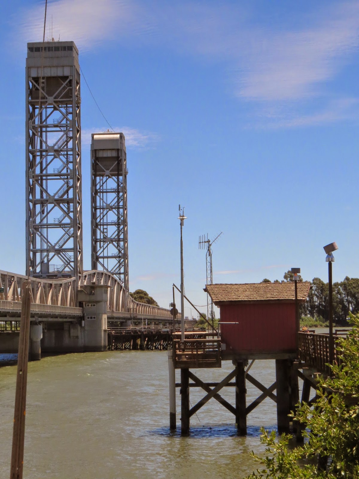
USGS acoustic Doppler devices near Rio Vista bridge keep track of fresh water outflow from Delta channels
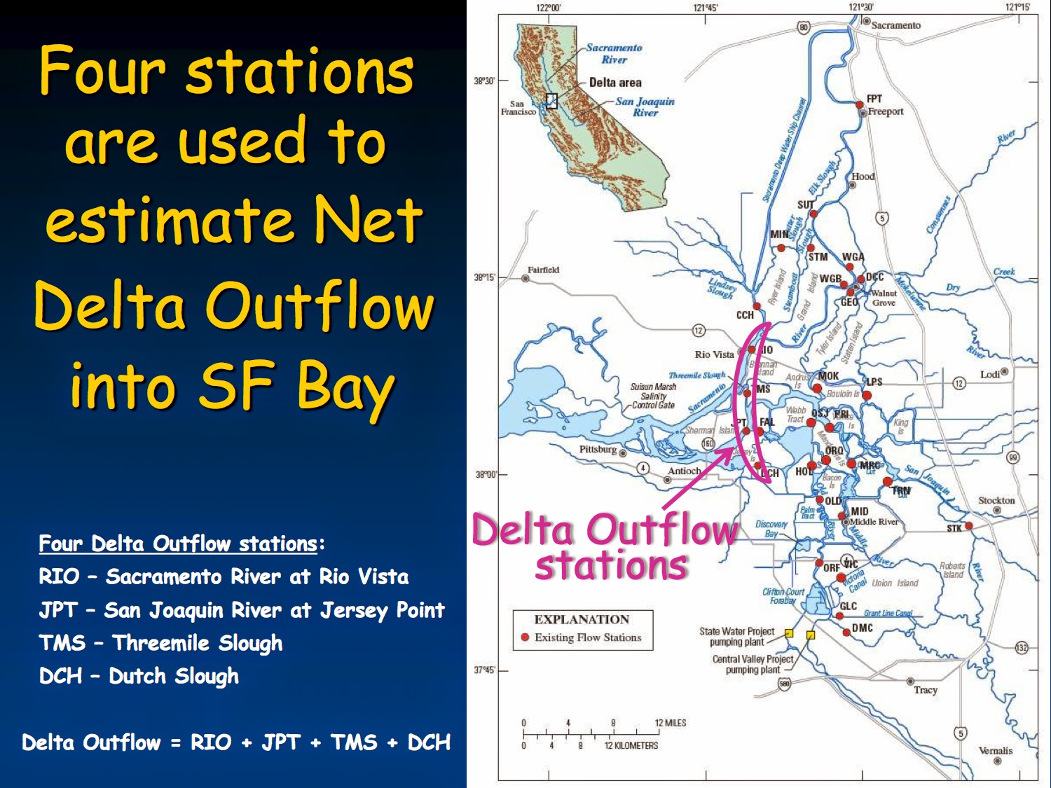
      This is the apparent condition of the Delta, according to state-of-the-art flow monitors operated by the USGS in four locations near Rio Vista and Brannon State Park (among others), where fresh water meets salty and becomes brackish.
       Official estimates of outflow, however, calculate that about  4,000 cubic feet per second (cfs) of fresh water is flowing into the Bay – admittedly low, but not zero, which would have important implications for managing water in this drought. State-generated outflow estimates are not based on the above USGS monitors, though it has been obvious for at least a year that there is a significant difference in dry years between the two methods of calculating flow.

Small Differences Matter During Drought

      In wetter years, a small disparity such as 3,000-4,000 cfs would not amount to much. This year is different. Drought is taking a huge toll in both northern and southern parts of the state. In the usually wet north, streams and rivers are near dry. The meager snowpack in the northern Sierras hit its runoff peak in April, not July, as usual. Ground water tables are sinking, not just in the San Joaquin Valley, but in some northern counties as well. Farmers throughout the state with junior rights have been ordered to stop diverting water for their thirsty crops.
      Under these conditions, sales of water from north to south – normal at this time of year –become problematic, even when the sellers are willing. And the condition of the Delta, through which the transfer waters must flow, is critical.

Suits Aims to Stop Transfers

Biostatistician Thomas Cannon challenges State outflow estimates in environmental suit.

Hoping to stop water transfers of 175,000 acre feet, approved by the U.S. Bureau of Reclamation this spring, two environmental organizations have filed suit in federal court. They requested an expedited hearing to halt the transfers that are scheduled to begin this month. Plaintiffs charge that the Bureau did not do a proper environmental analysis before approving the transfers, and the flow monitors maintained by the USGS in the Delta are poised to play a staring role in the case.
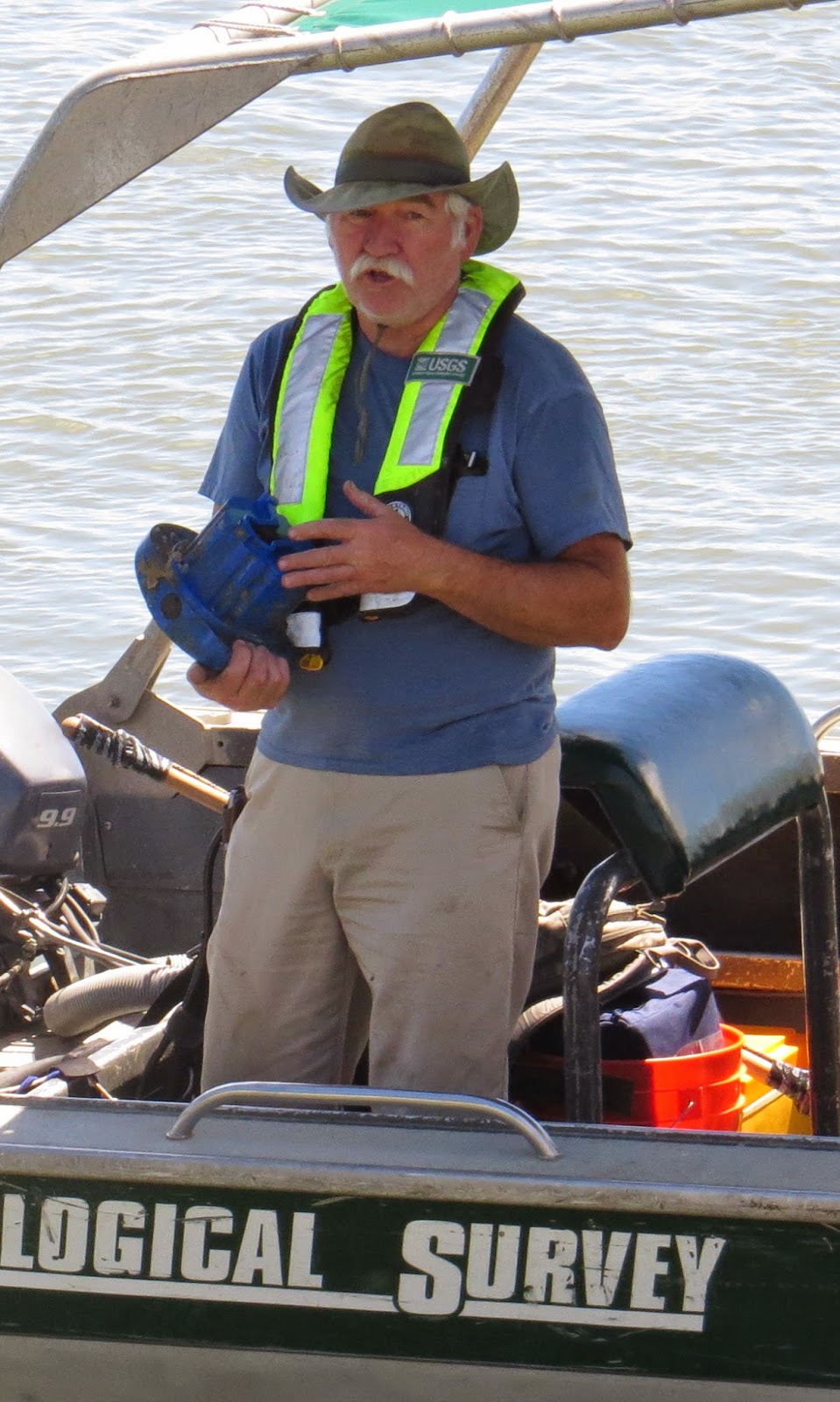
      “Their totals (measuring delta outflow) have been near zero since May,” said Thomas Cannon, a biostatistician whose work is cited in the lawsuit by the California Sportfishing Protection Alliance and AquAlliance. I've never seen it this salty up here,” said Cannon on a recent day in the Delta, waving his arm toward the docks at Brannon State Park.  Based on his analysis, the suit charges that the dayflow method used by State and Federal water officials “grossly overestimates actual Delta outflow” during dry years.
 USGS technician repairs an outflow monitor at Three-Mile Slough in June.

If the outflow is truly as low as the USGS monitors indicate, it means that salt water is constantly threatening to move up the estuary and that a number of fish species, including the iconic longfin and delta smelt, are at risk of being carried into the export pumps which carry water to the south of the State.

Accuracy of USGS Monitors Challenged

      Difference, however, does not establish worth. The man in charge of water operations for the State Water Project in California's Department of Water Resources, John Lehigh, challenges the idea that USGS monitors are more accurate than state estimates.  “I have seen no evidence that would lead me to conclude that this estimate of outflow (using USGS monitors) is more accurate than the one used now.” said Lehigh. He added that if someone thinks he has a better way to measure outflow, that person should bring the issue to the attention of the State Water Board. So far, no one has done that, he said.
      Lehigh also questioned whether the monitors located in the lower Delta, closer to the Bay, can truly detect outflow in the presence of tidal flux. Outflow in drought conditions (3,000 cfs, for example) is miniscule compared to the huge tides (150,000 cfs or more) that daily wash in and out of the lower delta.

Science panel Validates New Outflow Estimates

      Apparently, USGS scientists have been able to account for the tides, because a report to the Delta Science Program in February demonstrated that last year's salinity levels in the Delta matched the USGS outflow meters. Not so the estimates used by the state (called NDOI for Net Delta Outflow Index), which judged outflow to be more than twice as high as the USGS monitors in the fall of 2013. “The NDOI estimates appeared to be clearly incorrect,” said the science program's final report (page 15) released in May. The report went on to say that Delta outflow did not meet minimum standards last year and questioned why the better outflow measures are not being used now. For this blog, a member of the expert outflow science panel, retired USGS engineer Pete Smith, calculated the difference between the two measurements for May and June this year (see graph).
By official estimates, fresh water outflow from the Delta is about 4,000 cfs; USGS monitors show that outflow to the Bay vacillated between minus 6,000 cfs and plus 6,000 but the average for May and June was close to zero. Graph by Pete Smith

The same disparity that was evident in 2013 showed up again this year. NDOI estimates were way higher than outflow as measured by USGS monitors. Whereas California officials believe outflow in the Delta is around 4,000 cfs this summer, the actual figure measured where the Delta meets the Bay is about zero.  In light of these findings, the State Water Board will be looking at "possible changes in determining outflow," said SWRCB engineer Rick Satkowski.

Delta Smelt Not in Normal Habitat
      So what does this complicated science all mean?
      One possibility is that famous Delta fish species – the delta smelt and longfin smelt– could go extinct this year. Smelt follow a salt line called the X2 because they prefer brackish water. Normally the smelt are in Suisun Bay by the end of June, but this year they seem to be still swimming around in the central Delta, near Brannon. In addition to using possibly inaccurate measures of outflow (thus not releasing sufficient water from the reservoirs), the State has also relaxed its salinity standards this summer, bringing the X2 boundary further upstream. This means the precious few smelt that are left after years of decline are now directly in line of the pumps that take water south.
      “This year, the only delta smelt anyone's been able to find are in the Delta,” said Michael Jackson, an environmental lawyer who has filed public trust suits against the State in past years, but is not involved in this one.
Four USGS stations monitor outflow where Delta water enters the Bay; official outflow monitors are located further upstream toward Sacramento and where rivers enter the Delta.
      “Because there is no outflow, the only flow will be toward the pumps. Since transport goes right through the area where the last smelt are, it seems like we have put a tremendous amount of money and pain into preserving the fish, only to end up exterminating the species this year.”  Jackson said there is nothing in the Bureau of Reclamation's environmental report on water transfers that recognizes the threat to delta smelt.

Northern Communities also at Risk

      Nor is there anything that recognizes the danger to communities, farms or ecology in California's north, said Barbara Vlamis of AquAlliance, one of the plaintiffs. She said that the Bureau has simply asserted that no environmental harm will be done to northern areas selling the water, calling the assessment a “cheap and shoddy version of NEPA” (National Environmental Policy Act).
“Why are we selling water out of the north when the area will be rationing this summer? By percentage of normal precipitation, the north has been hit harder this year than the south,” said Vlamis.
      (Bureau officials have been making “temporary” one-time transfer decisions for years, thereby obviating the need for a full-scale environmental analysis on any one of them. The environmental suit is challenging this practice.)

Salt Levels Due to Affect Pumps

      Another thing zero flow means is that salt contamination of pumps that bring water to people in Contra Costa County, as well as southern parts of the State, will climb throughout the dry summer months. When salt rises too high, however, the Contra Costa Water District can dilute it with fresh water from Los Vaqueros Reservoir, so there is no imminent threat to urban areas. Too much salty water in the southern Delta could, however, stop the water transfers regardless of the outcome of the pending legal case.
      Who gets the water – if it goes through – is unknown. Buyers and sellers are anonymous until contracts are written. But if history and rumor are any guides, most of the water is destined to reach Westlands, the wealthy corporate farmers in Kern County, known far and wide for their political muscle in bending state and Federal policies to their private needs. And that's a shame. It is bad enough that these toxic lands, which release selenium into the waterways, get watered in wet years. It's a travesty when they get to use water during a drought like this – water that is critically needed to save the ecosystem and hold the salt at bay for the rest of us.

CALIFORNIA'S WATER STORAGE CRISIS: THE BATTLE AT TEMPERANCE FLAT
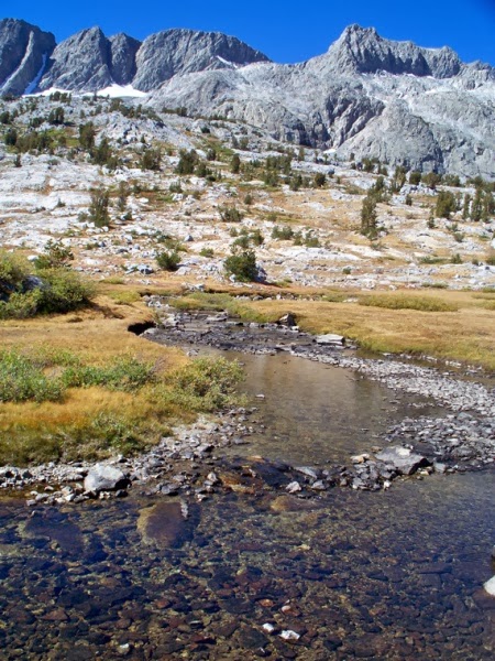
        Down the spine of California's Sierra Nevada mountains south of Yosemite, huge granite peaks stand shoulder to shoulder more than 13,000 feet high, with no passage through them. Only hikers can cross the rugged range for more than 200 miles.
Banner Peak and Thousand Island Lakes mark the headwaters of the San Joaquin River in the Ansel Adams Wilderness.    Photo by Alex Breitler
       These tall mountains – the Southern Sierras – extending from the San Joaquin River watershed east of Fresno to the southern edge of Sequoia National Forest, epitomize California's erratic water supply. In wet years, so much water pours down the mountains that its volume would scare the daylights out of any creature without wings. In drought years,  meager streams cannot fill the reservoirs.

A Year Like No Other

      “This year, no one has water” said Mario Santoyo, assistant general manager of Friant Water Authority near Fresno, a unit of the Federal Central Valley Project that provides irrigation for 15,000 farmers in eastern San Joaquin Valley. “The public has no idea how bad this is going to be....there will be nothing,” said Santoyo glumly. Friant Dam distributes water to more than a million acres of fertile fields that lie mostly east of highway 99, from Madera to Kern County. The area produces more crops per volume than any other in the nation.
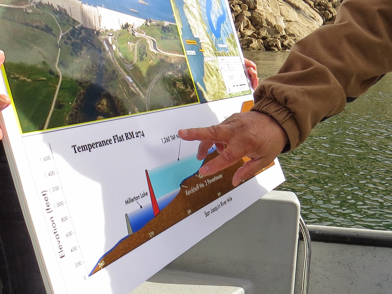
      Behind the dam, Millerton reservoir was dangerously low as of Feb. 7, and Friant's managers were scouring the state to find more water. We were on a boat on Millerton, touring the site of a proposed new dam, Temperance Flat, that could rise at the back end of the lake, more than doubling storage in the reservoir. (Because of its position in low hills, Friant Dam cannot be raised).

A Dam You Love or Hate

The proposed dam at Temperance Flat (red) would hold 1.2 million acre feet of water, extending another 16 miles up the river behind the current Friant dam (in gray and pictured at top)

Temperance Flat is one of the most controversial storage projects in California. Farmers want it; environmentalists oppose it; Federal officials have left it on the shelf for years. But this year, in the wake of California's epic drought year, the project is alive and well. Like nothing else, these months with no precipitation have driven home the awareness that California does not have enough water in storage to get through really bad dry periods.

      Friant farmers are particularly vulnerable this year, which helps explain why President Obama is coming to Fresno on Friday, along with Senators Dianne Feinstein and Barbara Boxer, who introduced drought-fighting legislation in Congress this week. The Senate bill counters a bill passed in the House by Republicans last week that would roll back the historic San Joaquin River restoration project, among other ill-considered features.
      A bit of background is needed to understand the stakes involved here and in the state at large. Nowhere do the competing forces of agriculture and ecology seem more tightly balanced than on the San Joaquin River at Friant.

Bright Dream; Original Sin

      Seventy years ago, the U.S. Bureau of Reclamation built this dam as the centerpiece of a hydraulic revolution in the San Joaquin Valley. By capturing the unpredictable waters of the San Joaquin watershed, Friant dam and its associated canals gave rise to an agricultural cornucopia, the pride of California and a major source of the nation's produce. Unfortunately, it also brought about one of the most painful chapters in California's water history, a history already full of painful chapters. The story is told in a moving account, The San Joaquin: A River Betrayed, by former McClatchy reporter Gene Rose.
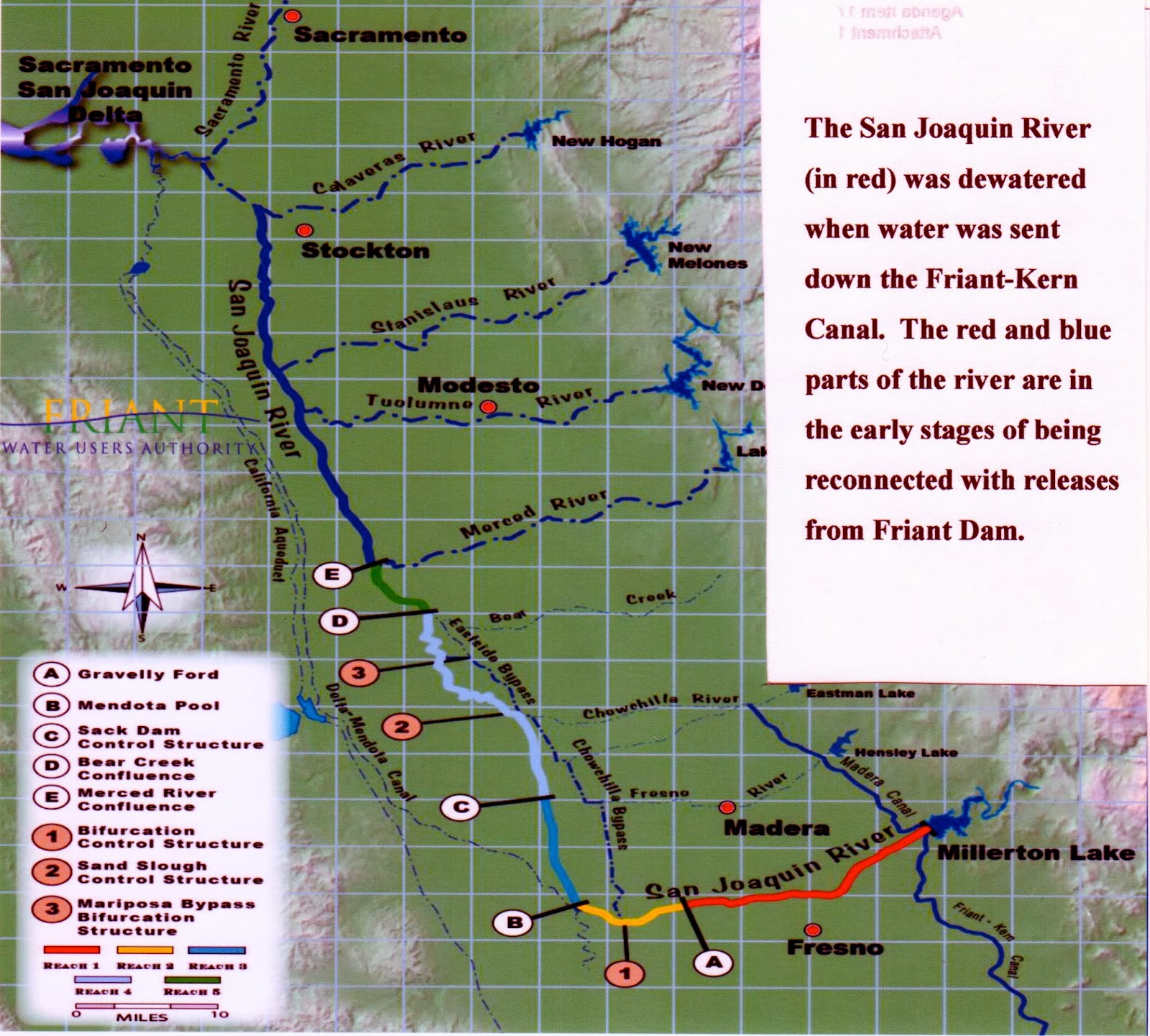
The Federal Central Valley Project in Fresno created two separate rivers.

In laying the concrete for this farming miracle, engineers completely reversed the flow of the San Joaquin River. They sent its waters moving south to Kern County instead of north to the Delta. The river that inspired John Muir disappeared within months. Salmon runs abruptly ended. Landowners along the course of the northern-bound river lost their water, among other deleterious effects.

      Today, the historic San Joaquin River disappears about 40 miles down from the dam, leaving a 60 mile stretch of nothing but dry sand. What ends up in the Delta, although called the “San Joaquin River”, is recreated every year out of mostly agricultural runoff that rotates repeatedly through the state water system. Its water comes with a bad mix of pesticides and tons of salt, including dangerous levels of selenium. Because it salts up the land, the recreated San Joaquin River threatens the survival of the agricultural marvel Friant Dam helped to inspire.

An Historic Win for the Ecology

A stretch of the once magnificent San Joaquin River, has been dry for 70 years. With restoration releases, it shows a meager stream of new water. Bureau of Reclamation

In one of the longest running legal cases of its kind, the Natural Resources Defense Council won a settlement seven years ago that forces the Friant Authority to release enough water into the old channel to restore the river and restart the salmon run. Environmentalists don't want any more water – not even flood waters – to be held behind any dam on the San Joaquin River. Besides, they claim, farmers already take up to 95 percent of the watershed's precipitation. Do they have to have the last .05 percent? Can't they let even one drop reach the ocean?

      Ronald Stork, policy director at Friends of the River, which helped win the restoration case in 2007 calls Temperance Flat a “dead beat dam.” He said there isn't enough yield from a new dam, over what is already taken, to justify its cost of about $3 billion. And, he added, that extra water will hardly make a dent in what farmers are currently pumping, leading to depletion of the aquifer, so its value in recharging ground water is limited.

The Case for Farmers

      Santoyo strongly counters such arguments. Flipping charts to show that flooding dramatically increased in the second half of the 20th century, Santoyo illustrated how much water is lost to agriculture. In 16 out of 35 years, from 1978 to 2013, Friant released water it could not store because Millerton is too small. In each of eight of those 16 years, more than 1 million acre feet were released – enough to irrigate Friant lands for about a year. Most of the flood releases went downstream into the old San Joaquin riverbed and eventually reached the Delta. But sometimes the water went everywhere.
Friant's Mario Santoyo: "I couldn't move the water."

In 1997 (the year that Yosemite Valley flooded), a rain-driven cascade of water came down the San Joaquin canyons that stunned Santoyo. It came so fast and in such volume (120,000 cubic feet per second) that no mere dam could hold it, certainly not Friant. It was like a football stadium full of water plunging into the reservoir every second, he said.

      Reclamation officials urgently called Santoyo: 'Can you move the water!?' they asked. “I couldn't,” he said. “There was no way I could move that much water through our canals.” The water simply flowed over the dam and down into the valley. “We needed a (bigger) reservoir to hold it back,” said Santoyo.

A Challenged Dam in an Era of Climate Change
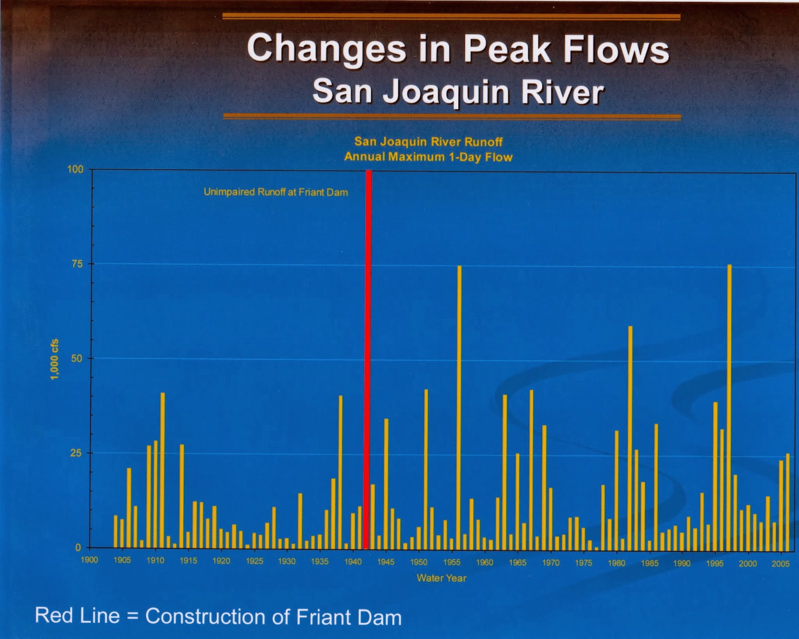
      Environmentalists argue that a flood like the one in '97 does not occur often, and that's true. But climate change science predicts increased flooding from rain in the Southern Sierras. And Friant is not built to handle incredibly fast, big floods that happen over a few days, as they do in a “pineapple express” or “atmospheric river,” as these warm rains are called.
Chart shows higher peak flows in the San Joaquin during 20th century, from 1905 to 2005. Photo from the Friant Water Authority

Unlike other reservoirs in the central/southern Sierras, like the two million acre feet Don Pedro Lake to the north, or the one million acre feet Pine Flat reservoir to the south, Millerton holds only 500,000. It works more like a diversion basin than a reservoir, in that it channels water immediately into the Friant-Kern and Madera canals. By this means, it sends most of the water –1.8 million acre feet – that comes down the mountains onto the fields.

Who Gets the High Water?

      But if Friant clients use most of the San Joaquin River water now, why put themselves into big debt building another dam? At most, Temperance Flat would increase their yield by 150,000 to 250,000 acre feet per year – not overly impressive. (Formal predictions on actual yield have yet to be released in feasibility studies.) One answer is that farmers are eager to store flood waters for use during dry periods and Temperance Flat would give them that flexibility.
      But the flood waters are exactly what environmentalists want to use in restoring the San Joaquin River downstream.
     “We want to get back to a healthy river,” said Kathryn Phillips, director of the Sierra Club California. She said the river needs more flow than the amounts contributed by the restoration agreement with Friant. “If you want groundwater recharge along the river, if you want a balanced ecosystem, then you have to let the river flow. Temperance Flat will not help that; it will harm it.”

Will the Salmon Run?

      Water policy officials like Randy Fiorini, chair of the Delta Stewardship Council, have reached the opposite conclusion. Charged with the responsibility of striking a balance between water deliveries to humans and protection of the ecosystem, Fiorini said he thinks the reservoir at Friant Dam is too small.
      “I've always been one to believe that if the upper San Joaquin is to be successfully restored, the Fresno reservoir needs another million acre feet of storage.” Only then, he said, can the state meet its co-equal goals on the east side: to provide both irrigation water in dry years and in-stream flows for fish.
      Santoyo hopes other Californians will agree with that point of view and support a state bond in 2014 that he expects will allocate money for studies at Temperance Flat. Aside from a drought, the one thing that scares Friant people most is being hauled back into court, losing more water because the salmon don't run. And they won't run if the water isn't cold enough. Millerton is a small, often warm lake, said Santoyo.
      “We just don't have the volume of cold water we need to restore the salmon. It's a high priority for us. We have to succeed in bringing back the salmon.”